This week’s weather will be consistently warm, humid, and mostly cloudy

Summary: After several days of sunny weather, a more southerly flow will take hold of Houston’s weather and that will bring us warm days and nights, mostly cloudy skies, and generally humid weather. This pattern of highs in the mid- to upper-80s will hold until the weekend, when a weak front is likely to move into the area, bringing showers with it.

Most of Texas, aside from the Panhandle, is starting the work week warm. (Weather Bell)

Monday

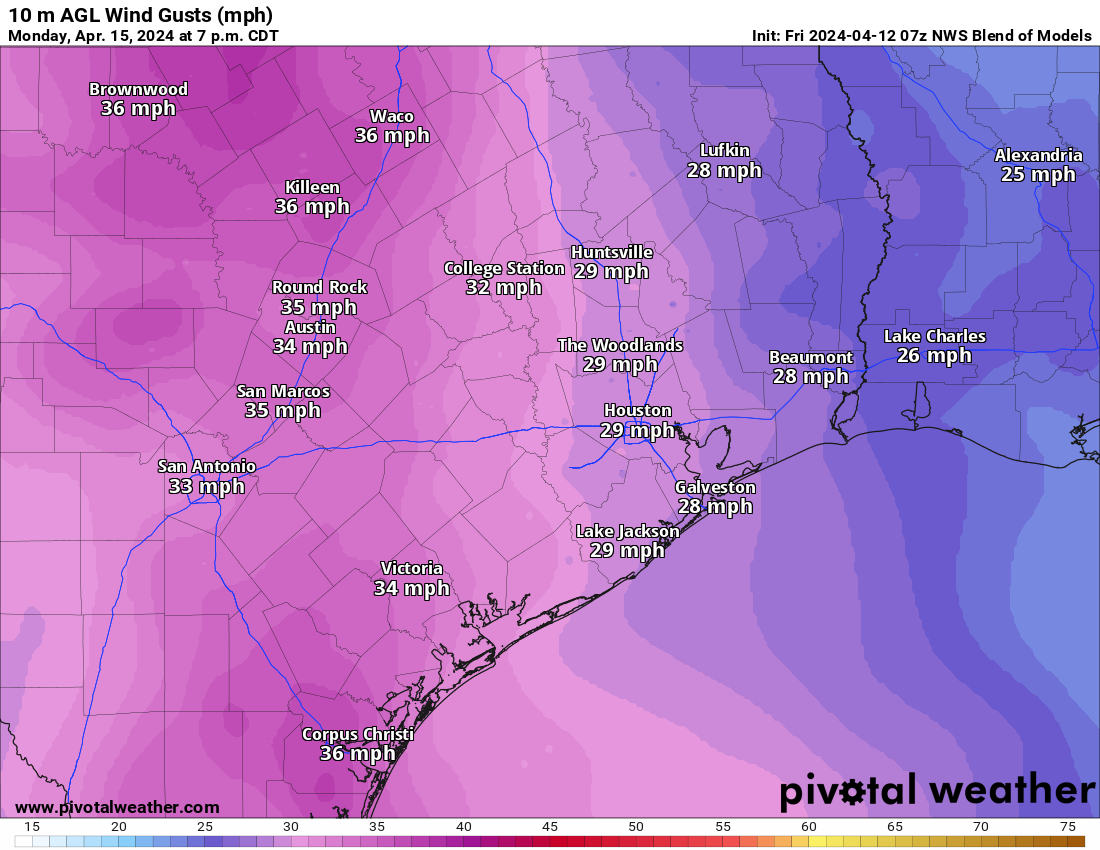
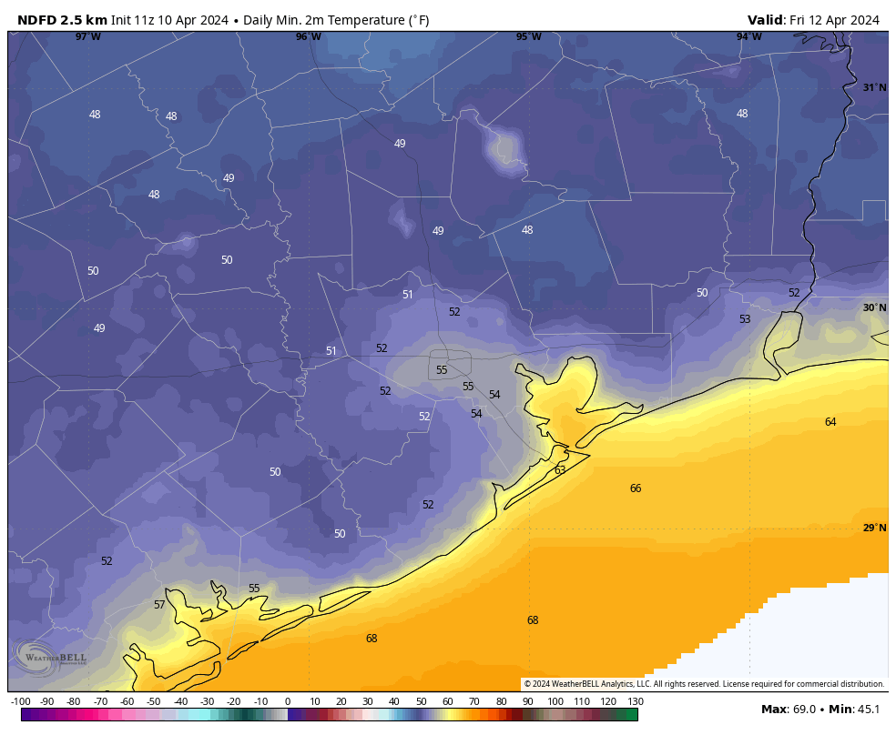
Highs today will max out in the low 80s, as the warm southwesterly flow that will bring warmer weather this week is not yet in place. But there will be plenty of moisture in the atmosphere and, accordingly, mostly cloudy skies. Winds will blow from the south at about 10 mph, with occasional gusts up to 20 mph. Lows tonight will drop only to around 70 degrees in Houston.

Tuesday

The area may see a few isolated to scattered showers early on Tuesday in association with a front that will die far to our west, but otherwise we’ll continue to see mostly cloudy skies. Highs will be in the mid-80s with a warm, southerly breeze.

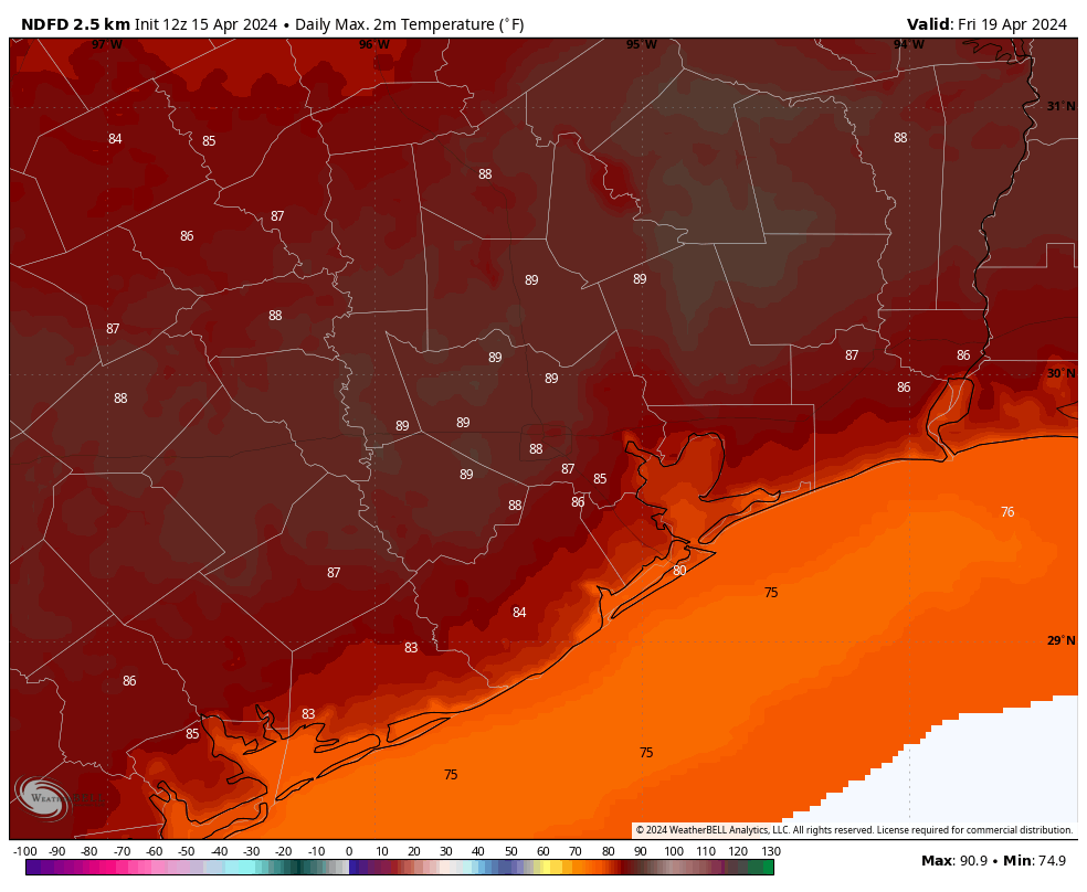
Wednesday, Thursday, and Friday

These days will be warm. Skies will be partly to mostly cloudy, but if we get some breaks in the sunshine during the afternoon hours some locations could hit 90 degrees. For the most part, however, we’ll be in the mid- to upper-80s with plenty of humidity. Nights will be very warm for April as well, with lows only dropping into the low-70s. Rain chances are not non-existent, but they’re likely around 10 percent each day.

Friday may well be the hottest day of the week. (Weather Bell)

Saturday and Sunday

The weekend forecast remains in a bit of flux, depending on the timing of a weak front. My best guess is that Saturday brings partly sunny weather, with highs in the mid- to upper-80s, and that there’s a decent chance of rain Saturday evening or overnight ahead of the front. Rain chances linger on Sunday, with highs perhaps in the 70s and some modestly drier air. In a day or two we should be able to iron out some of these details.

Next week

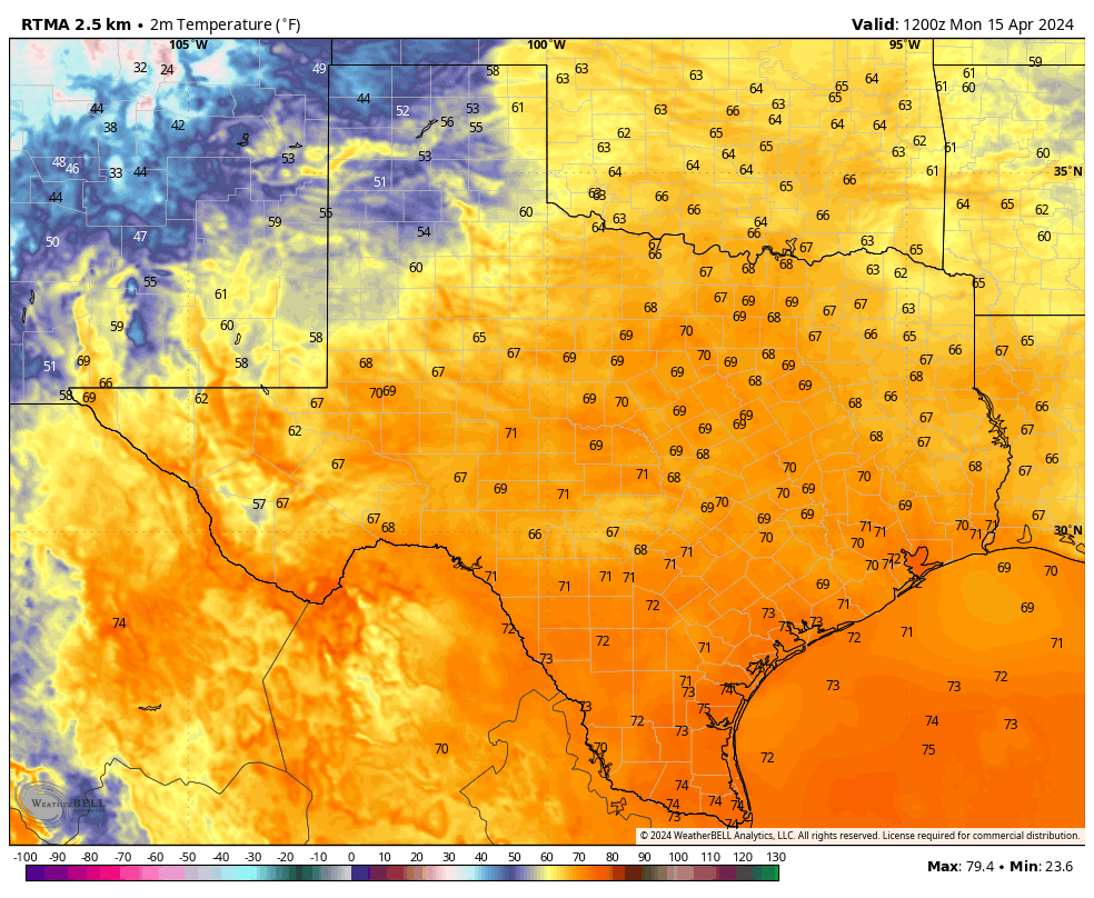
After a couple of cooler days, and nights with lows perhaps around 60 degrees, we’ll probably be back in the mid-80s by the middle of next week.

A calm, mostly pleasant weekend settles in for Houston before at least a chance at our first 90 next week

Summary: Quiet weather continues through the weekend before we eye up some heat and rain chances again later next week. There’s about a 40 to 50 percent chance we hit our first 90 degree day of the year next week.

Today through Sunday

After a wild Wednesday morning, things calmed down dramatically as expected yesterday. After another cool morning, we should warm back up into the 70s or near 80 degrees this afternoon. Humidity will remain low, and winds will be lighter than Thursday.

For Saturday, look for more sunshine with clouds, morning lows in the 50s, and highs sneaking back above 80 in most spots away from the coast. We should notice a lot more humidity and more clouds around on Sunday. The morning will start out noticeably milder, with low temperatures only in the mid-60s. Expect to see highs in the low to mid-80s under partly sunny skies.

Monday

Things start to change a bit Monday. One thing we will notice is more wind. Breezy conditions set in probably by Sunday but on Monday, they’ll nudge up a little with gusts over 30 mph at times and stronger at the coast and southwest of Houston.

Wind gusts of 25 to 35 mph will be likely on Monday, with even some higher gusts possible at the coast and down toward Matagorda Bay. (Pivotal Weather)

Morning lows will be well into the 60s and highs in the 80s. Rain chances remain low. I do expect to see some additional clouds on Monday, and as is often the case with an influx of humidity in springtime, some showers or sprinkles can’t be entirely ruled out.

Tuesday through Thursday

The chance of rain remains pretty low in the Houston area for most of next week because we expect to see a pretty robust capping inversion in place over the region. This implies that in a layer in the atmosphere, temperatures will actually warm as you go up. This creates what is basically a block in the atmosphere to limit cloud growth and thus reduce rain chances. This is common in spring in Houston and is why we see far less really severe weather than our neighbors to the north and west in the Plains. While things could change, for now expect isolated showers, a slight chance of a thunderstorm, and otherwise partly to mostly cloudy skies into Thursday morning, with increasing rain chances thereafter.

From Tuesday (above) and especially into Wednesday and Thursday, we expect high temperatures to flirt with 90 degrees in much of the area, along with humidity. An early summer preview. (Pivotal Weather)

Otherwise, it’s going to get warm with an early summer preview. Right now, we have about a 40 to 50 percent chance to top out at 90 degrees in Houston officially on Wednesday or Thursday. Parts of the Rio Grande Valley should push 100 degrees as well. For Houston, the average date of our first 90 degree day has occurred on April 29th since 1995. We’re getting close.

Wet bulb globe temperature shows mostly elevated heat and pockets of moderate heat next Wednesday afternoon. It will be hot for April, but if you’re new here, this is just scratching the surface. (NWS)

Last summer we started using more charts of “wet bulb globe temperature” (WBGT) instead of heat index. The WBGT looks at numerous factors besides just temperature and humidity and tends to offer a more realistic view of how serious the heat will be for our bodies. Last summer saw numerous days in the high and extreme category. While it will get hot and humid later next week, as of now we’re sitting mostly in the elevated to moderate level for heat. So this will serve as a reminder that summer is coming, rather than feel a ton like summer. I’m mostly showing this today to start getting you comfortable with how these categories work; instead of a number, we see a category. And lots of people continue moving to this area. You’ll be seeing a lot more of this during summer.

It does look like storm chances and front chances will increase late next week or weekend, but we’ll look into that more on Monday.

Houston to enjoy a few days of splendid spring weather before a warmer and more humid pattern

Summary: Today will be breezy as more dry air filters into the area, but winds will settle down later this afternoon. We’ll see a couple of cooler days and nights, with low humidity, before the onshore flow returns and our temperatures begin to ramp up into the 80s. Rain chances look low to nil for at least the next week.

Thursday

We’re continuing to see a pronounced breeze from the northwest this morning in the wake of Wednesday’s cool front. With clear skies and appreciably drier air today, highs will reach about 80 degrees. But we’ll cool off nicely tonight as winds subside, with lows dropping into the mid-50s in Houston, and even further for inland areas. This will be a fine, chilly night. I am really going to miss spring when it’s gone.

Friday morning will dawn chilly for much of Houston. (Weather Bell)

Friday

Another sunny day with dry air. Highs again will be in the vicinity of 80 degrees. However winds will begin to shift, first from the east, and then the southeast overnight. Initially they’ll be pretty light, but this is the beginnings of the onshore flow. Even so, lows on Friday night should drop into the upper 50s in Houston.

Saturday

The first half of the weekend will bring more nice weather, with temperatures of about 80 degrees, and only a few more clouds. We will also start to feel an uptick in humidity, but with dewpoints still in the 50s, it will still feel quite nice. If you’re planning to attend any of the Art Car Parade festivities this weekend, you can be confidence in pleasant weather, albeit with a bit of a southerly breeze. Lows on Saturday night will be warmer, dropping perhaps only into the mid-60s.

Sunday

We’ll still see some sunshine on Sunday, but there will be more clouds mixed in, and humidity will be on the rise. Look for highs in the low- to mid-80s. Sunday night temperatures may not drop below 70 degrees for much of the area.

Next week looks warm for Texas and the eastern United States. (Pivotal Weather)

Next week

Much of next week looks partly to mostly cloudy, with warm days in the mid- to upper-80s and nights in the 70s. It won’t be absolutely sultry, but it will feel more like summer than we’ve felt in awhile. There is a signal for some kind of front by around the end of the week, which should cool us down a bit, and may (or may not) be accompanied by some showers. But that part of the forecast is best written in pencil.

After a nasty line of storms moved through, clear skies ahead for Houston

Summary: After early morning thunderstorms, some of which produced severe straight-line winds, calmer weather is moving into Houston. We’ll see mostly sunny weather later this morning, and that will last well into Saturday at least. The next couple of nights will also be chilly—something that will not last much longer this spring.

Overnight storms

Well, did those storms wake anyone else up? The line hit my neighborhood shortly after 4 am CT, and we have significant tree damage as a result. For a few minutes it was pandemonium as a core of very strong winds reached the surface. According to the National Weather Service there were no indications of tornadoes in the Houston metro area. However there were significant winds accompanying the line of storms, with some gusts reaching 60 to 80 mph.

This cloud loop, ending shortly before 6 am CT, shows the progression of storms on Wednesday morning. (NOAA)

Reports are already rolling in from places as varied as Katy and San Leon of building damage and downed power lines. The good news is that the worst has now passed, and we’ll have several days of much more calm weather to clean up the mess. Additionally, the region picked up some much needed rain with warmer days ahead, and the likelihood of no meaningful precipitation for the next week or so. Most of the area picked up 1 to 3 inches of rain, but a few outliers picked up 4 inches overnight.

Wednesday

As of 6 am CT the strongest line of storms has already reached Beaumont, leaving light rain in its wake in Houston. This rain, too, should end by 7 or 8 am this morning at the latest, and we’ll see northwesterly winds as a front moves into the region. Skies will begin clearing before noon, and afterward we’ll clear out completely. Highs will be in the upper 70s today. The only note of concern is that beginning around noon, and lasting for about 24 hours, we’ll see a fairly stiff north-northwest wind. At times these winds may gust up to 30 or 35 mph. This is the price of drier air in April. Lows tonight will drop into the upper 50s.

Thursday

Aside from the aforementioned winds, which should start subsiding in the afternoon or early evening, this will be a splendid day. Skies will be sunny, with ample dry air. Highs will reach about 80 degrees. Lows will drop into the low- to mid-50s, with cooler conditions for outlying areas. As I’ve been saying, this is likely to be one of our last truly chilly nights of the spring, so if that’s your jam, I suggest you be jamming.

Low temperature forecast for Friday morning. (Weather Bell)

Friday

Another stellar day. This time, there will be no wind concerns. Skies will be sunny, with highs of around 80 degrees. There will still be plenty of dry air, but with the resumption of an onshore flow that will begin to change. Lows on Friday night will drop to around 60 degrees.

Saturday and Sunday

The weekend looks fine for outdoor plans. Saturday will be partly to mostly sunny, with a high of around 80 degrees. Humidity will be rising, but it won’t really start to feel humid until Sunday. There will be a few more clouds during the back half of the weekend, but highs will still manage to reach the low- to mid-80s. By Sunday night our lows will only be dropping to around 70 degrees.

Next week

Most of next week looks warm, with highs in the mid-80s perhaps, and a mix of sunshine and clouds. We’ll see a fairly continuous, robust southerly breeze. It will feel humid outside, but certainly not the kind of humidity we’re used to feeling later in the summer months. The next front looks like it may be about 10 days away.