In brief: There are several things to watch for in the forecast, including hot temperatures today, some isolated thunderstorms tonight, and the potential for rain on Sunday and Monday in the absence of high pressure. Also, if you enjoy dry air, then Friday night and Saturday morning will be your time to shine.
Thursday
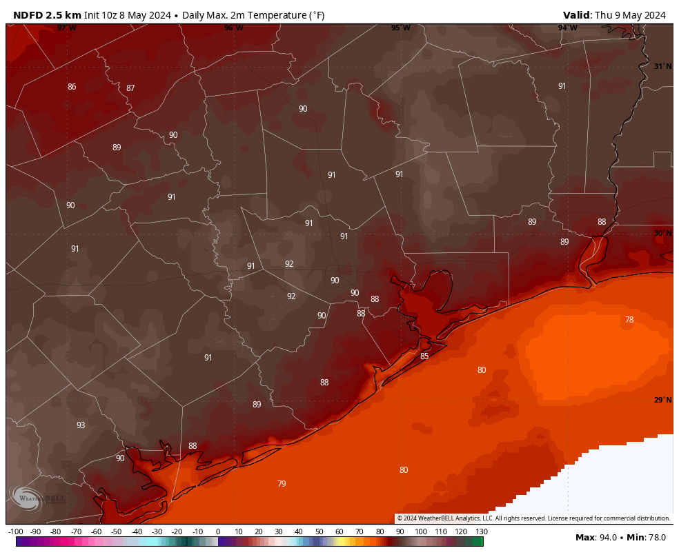
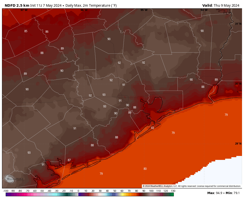
Houston will experience one more warm and particularly humid day today before we cool off slightly. Whether temperatures hit 90 degrees today will depend partly on sky cover this afternoon, when skies should be partly to mostly cloudy. Winds will generally be light, from the southeast at 5 to 10 mph.
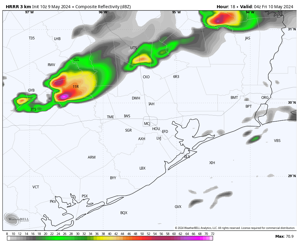
By this afternoon a front will be approaching the area, and this may serve as a trigger for some isolated thunderstorms later this evening. I think the most likely scenario is that these storms weaken before pushing into the Houston metro area, to the west of Katy and north of Tomball. However, there is a slight risk of development over Houston itself, in which case we may experience some briefly heavy rainfall and the potential for hail. So the risk is low, but non-zero this evening. Lows tonight should drop into the 70s in Houston.
Friday
Drier air will slowly filter in to the region during the daytime on Friday, when I expect to see mostly sunny skies with highs in the mid- to upper-80s. Winds will be from the northwest at about 10 mph with some higher gusts. Lows on Friday night drop into the upper 60s to 70 degrees for most locations.
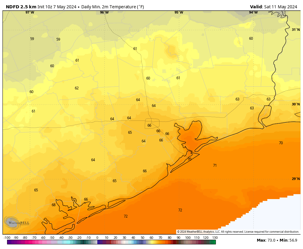
Saturday
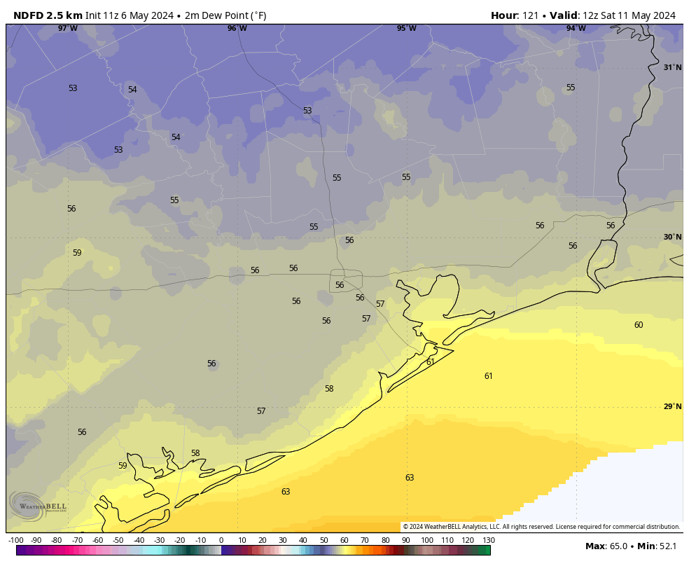
The first half of the weekend looks fine, with partly sunny skies and highs in the low- to mid-80s. Dewpoints should reach their low point on Saturday morning, so if you’re someone who likes drier air, that will be a good time to be out and about. As you might know, Houston doesn’t get much (ok, any) of that during a typical June, July, or August. Lows will drop to about 70 degrees on Saturday night as the onshore flow returns.
Sunday
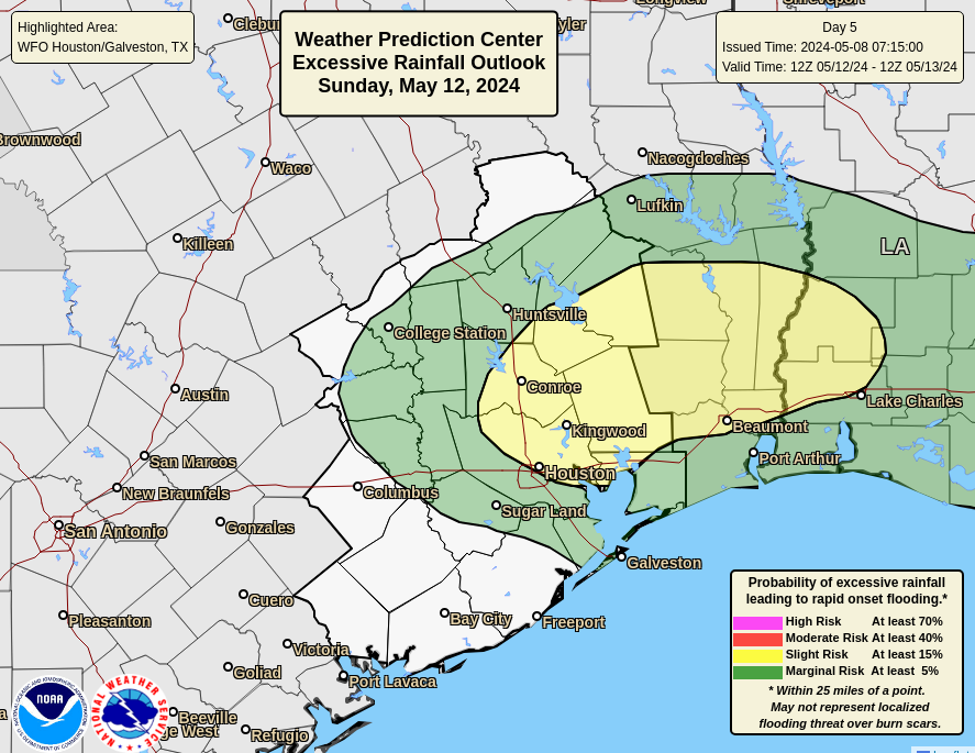
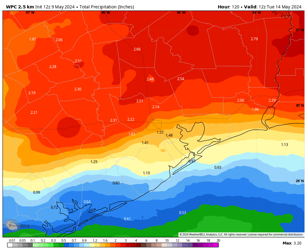
Mother’s Day won’t bring much sunshine, alas. In fact as high pressure exits the area, our atmosphere will open up to a series of disturbances that will bring decent rain chances through the middle of next week. For Sunday, this means scattered to widespread showers. There is a risk of heavy rainfall, particularly north of Interstate 10, but for the most part these should be reasonable rains I think. In any case, please consider the possibility of showers on Sunday as you make plans for mom. Highs will be about 80 degrees with returning humidity.
Next week
We’ll see additional disturbances next week, and while the details are difficult to pin down, I expect to see a healthy chance of rain on Monday (highest), Tuesday (lowest), and Wednesday (medium) of next week. Regardless, it’s not going to be wall-to-wall rain, as there should be a fair amount of sunshine mixed in as well, with highs generally in the upper-80s. Rain chances diminish toward the end of the week, with highs likely around 90 degrees to go along with warm, humid nights.