Winds whip, as more unsettled weather begins to arrive in the Houston area

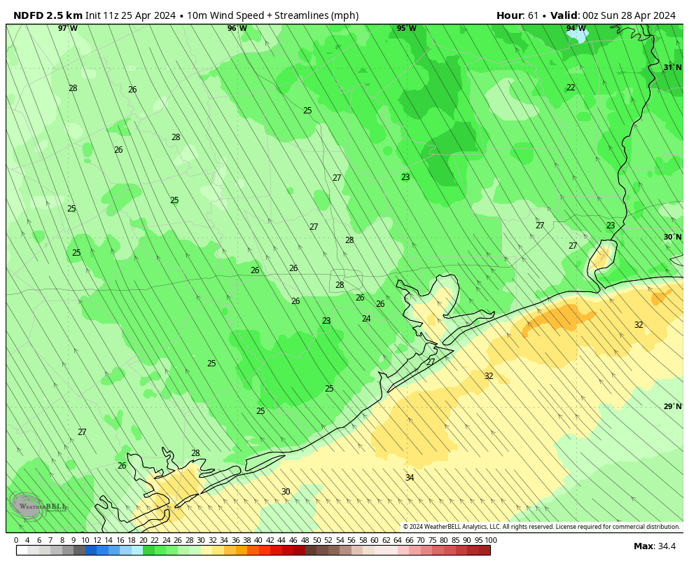
In brief: The word for the weekend is windy. We’ll see 30 to 40 mph wind gusts at times through Saturday, before things calm a bit by early next week. The weather will turn unsettled, with variable chances of daily showers and storms well into next week. We’ll likely see isolated activity today and slightly better rain coverage on Sunday and Monday.

Today

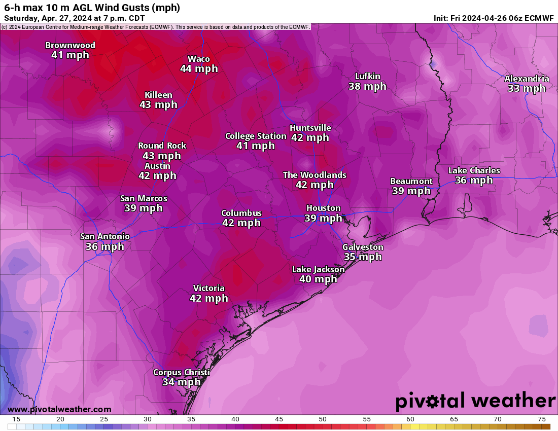
Hold on to your hats, folks. Wind gusts started picking up yesterday afternoon, up to about 30 mph or so. We will likely see that again today, perhaps most of the day this time. Wind will be the most noticeable element over the next few days. A few showers or even a thunderstorm are possible later this afternoon, with the highest chances north of Houston. Highs will be into the 80s once again.

A couple showers or even a thunderstorm will be possible into the first half of the overnight hours tonight.

Saturday

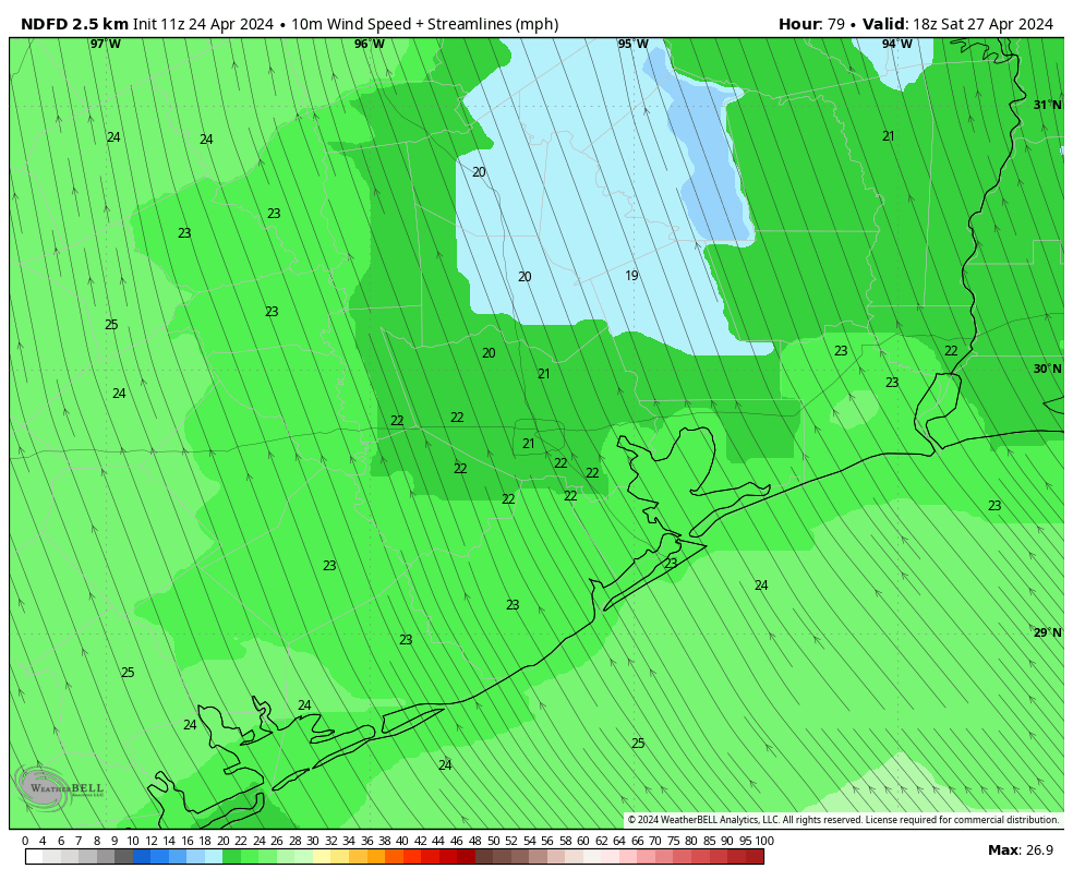
Saturday just looks like another windy, warm, humid day. Winds should be at their strongest on Saturday, with gusts as high as 35 mph or even stronger over the water.

Wind gusts of 30 to 40 mph are likely on Saturday across most of the area, with rough seas and bays. (Pivotal Weather)

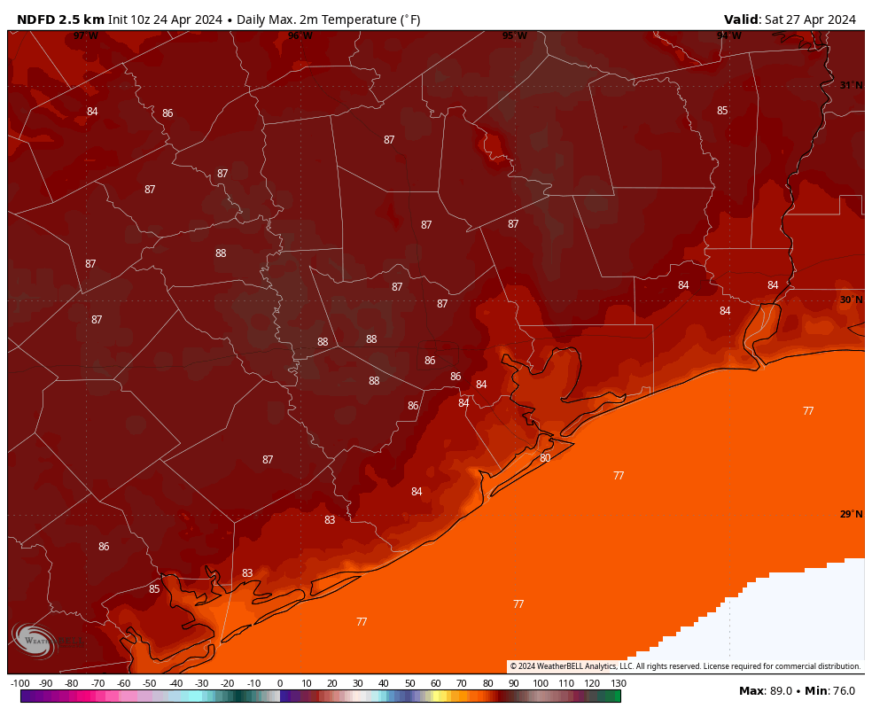
Highs in the 80s, lows in the 70s.

Best of luck to any IRONMAN participants or MS 150 riders. We think Saturday will have that solid southeast or south-southeast (mostly) tail wind, at times 30 to 40 mph. For those less seasoned MS 150 riders, please exercise caution with some of the gusts you’ll experience.

Sunday and Monday

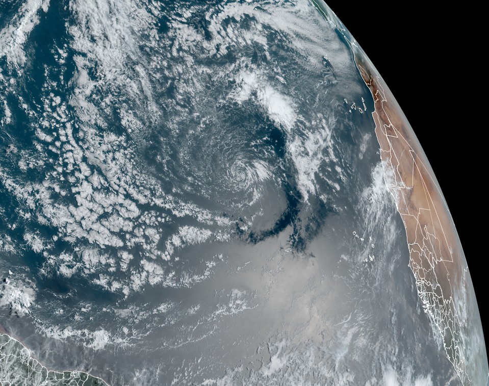
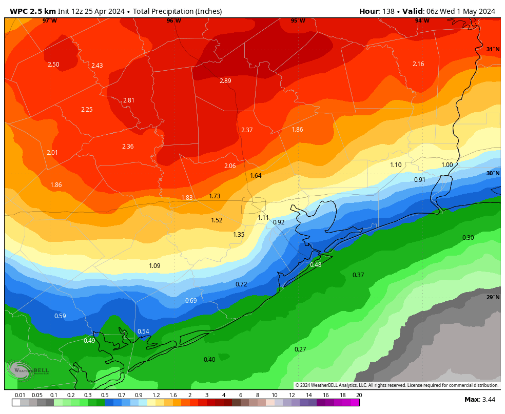
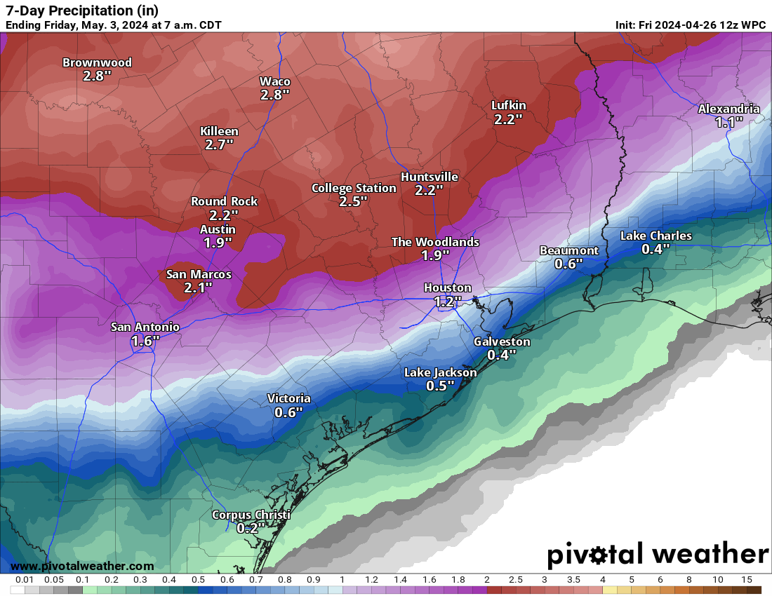
Winds will slowly subside on Sunday, but we should still see plentiful 20 to 30 mph gusts. It’s beginning to look as if a line of thunderstorms will develop in Hill Country in the predawn hours Sunday, sweeping east and southeast while weakening. They may fire back up as they approach the Houston area in the afternoon hours. Details on this are still somewhat TBD, but a couple hours of heavy rain, gusty winds, and lightning are a good possibility anywhere in the area Sunday afternoon. Severe weather can’t be entirely ruled out, but it’s not highly likely for Houston.

This will be something to watch for MS 150 riders, as the storms could be better organized crossing I-35 and approaching the Brazos Valley and College Station. It will have to be a Saturday or Sunday gametime decision in all likelihood.

Monday will see additional chances at scattered showers and storms. Whether it’s hit or miss activity or something more widespread and organized remains to be seen.

Another round of highs in the 80s and lows in the 70s are expected both days.

On average, rainfall through next week should be around an inch in Houston, less toward the coast, and more north and northwest of the city. There will be a lot of variability in these totals, however and higher amounts are a good possibility in spots. (Pivotal Weather)

Rest of next week

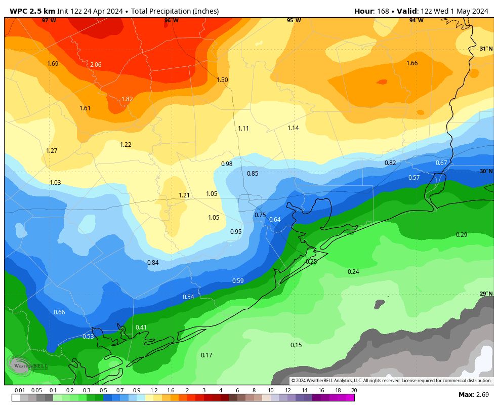
We will likely continue with daily shower and storm chances into next week. Some days will have better rain chances than others, but because there’s a lot of quick moving traffic in the upper atmosphere, it’s a little difficult to try and time when a disturbance will hit and produce storms here. The good news is that the severe weather risk continues to look mostly north of our area. We will continue with fairly stable temps and high humidity, with highs in the 80s and lows mainly in the 70s.

Warm and windy weather begins today, with gusts peaking on Saturday near 40 mph

In brief: Houston is beginning the first of four days of warm and windy weather, with Saturday looking especially gusty. Rain chances start to increase on Sunday afternoon, with much of the region in line for a decent soaking to start next week. This post also briefly touches on the looming onset of an active hurricane season, which begins in a little more than a month.

A few notes on the tropics

The National Hurricane Center issued its first “special tropical weather outlook” of the year on Wednesday, concerning a low pressure system far out in the Atlantic Ocean. This system has virtually no chance of becoming even a subtropical depression, but it is a sign of things to come. We are just a little more than five weeks away from the official beginning of the Atlantic hurricane season, but it would not surprise me to see a May storm this year given the warmth in the Atlantic tropics.

Wind shear is likely to prevent the swirl of clouds in the center of this satellite image from developing into a tropical system, but it’s a sign of things to come. (NOAA)

Another fairly influential group, at the University of Pennsylvania, issued its tropical forecast this week. The researchers predict a blockbuster season, with a best estimate of 33 named storms. This seems preposterously high, but typically the Pennsylvania forecast predictions are reasonably accurate, and typically conservative relative to overall activity. It’s another reason for concern. Speaking of the busy forthcoming season, Matt and I want to thank Houston City Councilwoman Abbie Kamin for the shoutout at City Council on Wednesday. Finally, this is a tax-free weekend for purchasing hurricane supplies in Texas. Details here.

Thursday

We’ll begin to see stronger southerly winds today as pressure gradients tighten in response to lower pressures over the central United States. This will help to create a persistent southerly flow over the region through the weekend, and peaking on Saturday. Today, winds will blow from the southeast at 10 to 20 mph, with gusts up to 30 mph. Skies should be mostly cloudy, with highs reaching the low 80s for most locations. Winds will continue overnight, with lows only dropping into the low 70s.

Friday

Another mostly cloudy and windy day. Highs might be a degree or two warmer than Thursday, with wind gusts possibly reaching 35 mph. Some showers and thunderstorms will be possible on Friday afternoon and early evening, but I think these will be fairly scattered due to a capping inversion. For now I’d peg rain chances at perhaps 10 to 30 percent. Friday night will be warm again.

Saturday

The first half of the weekend should see the strongest winds of the week, with south-southeasterly gusts up to 40 mph possible from the south. We should also see at least partly sunny skies, allowing highs to reach the mid-80s, and possibly the upper-80s for some locations. We covered the Texas Bike MS 150 in depth in yesterday’s post, and the forecast remains similar. If you’re participating in that, or the Ironman event in The Woodlands, be prepared for warm, humid weather and very strong winds from mid-morning through Saturday evening.

Forecast for sustained winds at 7 pm on Saturday. Gusts will be higher. (Weather Bell)

Sunday

Another warm and windy day, although gusts should be a bit lower, perhaps only reaching 30 mph from the south-southeast. Look for highs generally in the mid-80s with partly sunny skies giving way later to clouds. Beginning Sunday afternoon in the Houston area, in response to an upper-level system, expect to see rain chances increase across the area. Chances on Sunday will be greatest to the northwest of Houston, bust most of the region will probably see a smattering of rain on Sunday afternoon, evening, or overnight.

NOAA rain accumulation forecast for now through Tuesday. (Weather Bell)

Next week

Monday and Tuesday will see a healthy chance of rain showers, although the details remain uncertain about amounts. I’m hopeful that much of Houston will pick up 0.5 to 1.5 inches, which would be welcome given our drying soils this week. For the most part we can expect highs in the mid-80s to upper-80s later next week, with lows around 70 degrees. Humidity looks high all week. There could be a fair amount of sunshine. We’ll see.

Houston to warm up, and taking a deeper look at this weekend’s winds and rain for the MS 150 bike ride

In brief: Houston will see continued warm weather, with windy conditions beginning Thursday and persisting through the weekend. Starting Sunday we’ll start to see some rain chances that will likely peak on Monday. In this post we also take a look at winds and a potentially rainy second half for the Texas Bike MS 150 ride.

Wednesday

Much of the area has only dropped to around 70 degrees this morning, with a warmer flow in place. Today will see temperatures warm into the low-80s for most locations, although clearing skies later this afternoon could allow some locations to pop up a few degrees higher. This will be the last day for awhile that we don’t experience a fairly pronounced southerly wind, so enjoy the calmer air. Lows tonight will, again, only drop to 70 degrees or a bit lower with a humid air mass in place.

Thursday

While Wednesday is likely to see some clearing skies during the afternoon, I think Thursday will remain mostly cloudy. In response to a front advancing across the central United States we’ll see an uptick in winds from the south on Thursday, with gusts up to 25 mph possible. (Said front, alas, isn’t going to make it into our area). This southerly flow will bring more warmer air into the region, but I think the aforementioned clouds will limit highs to the mid-80s. Expect another warm night.

Friday

Another warm, windy, and mostly cloudy day. We’ll see a slight chance of showers during the daytime, maybe 20 percent.

High temperatures on Saturday (and probably Sunday) will be toasty. (Weather Bell)

Saturday and Sunday

Saturday looks to be the warmest day of the week, and our high temperatures will depend on the extent of clearing skies. I do think there will be some breaks during the afternoon hours, so some locations will reach the upper-80s, probably. Winds will really be ripping on Saturday, as well, with southerly gusts perhaps up to 35 mph or even a tad higher in some locations.

Sunday should see a slight diminution in winds, but some gusts up to 30 mph will still be possible. Rain chances are also increasing for Sunday, especially for areas inland of Interstate 10. I’d put chances at about 40 percent in the Houston area. For the most part these should be light to moderate showers rather than thunderstorms, but it’s something to consider if you have outdoor plans on Sunday afternoon or evening. Highs should be solidly in the mid-80s.

Texas Bike MS 150 weather

Saturday looks fine for the ride from Houston, which generally follows a western route. The day will be rather warm, with partly sunny skies most likely. Winds will generally be from the south-southeast, with some fairly strong gusts. While these won’t be tailwinds, they should be cross-tailwinds, so they’ll help rather than hinder. (By contrast, if you’re planning to ride your bike from Houston to Galveston on Saturday, good luck). Rains will not be an issue.

Sustained wind forecast for Saturday at 1 pm CT. (Weather Bell)

On Sunday, the MS 150 bike ride generally turns more north-northeast. Winds on Sunday will not be as pronounced as on Saturday, but they’ll still be blowing at 10 to 15 mph with stronger gusts. These south-southeasterly winds won’t be perfectly be at your back, but they should be more of a tailwind than a crosswind. So that’s all good. My concern is precipitation, especially beginning in the late morning hours. Showers will definitely be possible near places such as Brenham and College Station. Right now these don’t look too much like thunderstorms, but it’s something to monitor.

NOAA rain accumulation forecast for now through Tuesday. (Weather Bell)

Next week

The disturbance that will initiate some showers on Sunday will persist into Monday, and perhaps Tuesday morning. This will bring a decent chance of showers across the area, with accumulations of perhaps a few tenths of an inch of rain for most, with higher isolated totals. I’ll be happy for any rain I can get. Most of next week looks warm, with highs in the mid- to upper-80s and lows down around 70 degrees. It’s not summer, but we’re inching there.

Is this Houston’s last night in the 50s for at least five months?

In brief: Houston may be experiencing its last truly chilly night until next fall. (That was painful to type). After this we’ll be transitioning to warmer weather, with temperatures eventually reaching the upper 80s this weekend, with a persistent southerly wind. Rain chances increase a bit on Sunday, and a little more on Monday.

Final night in the 50s?

This is not a firm prediction, but rather an informed guess. Temperatures this morning are in the 50s across Houston, with even a few spots in the 40s, such as Conroe and Cleveland. But alas, this could be our final fling with such cooler weather. In fact, it would not surprise me if we do not see another chilly night like this for five or more months.

It is pleasantly cool this morning across much of Texas. But summer is coming. (Weather Bell)

Why is that? We certainly can see cooler nights in May, before the real onset of summer. But lows in the 70s are much more common in May than lows in the 50s. Last year, Houston saw its final springtime night in the 50s on May 1. We did not touch the 50s again until October 8. This year I don’t see any evidence of a cooler night during the next 10 days, at least. Hopefully we won’t have to wait all the way until October again.

Tuesday

Winds are now firmly coming from the south, but it will take some time to replace the drier air mass that has been in place since Sunday. Accordingly, we’ll see a mix of sunshine and clouds today, with highs in the upper 70s to 80 degrees. Moisture levels will rise, and by this evening it will start to feel fairly humid. Winds will be light, generally only 5 to 10 mph, from the south-southeast. Lows tonight will only drop into the upper 60s.

Wednesday

Temperatures will be a bit warmer, in the low 80s, with a bit more humidity. I think skies will mostly clear out in the afternoon, allowing for a fair bit of sunshine. Overnight lows will only drop to about 70 degrees.

Thursday and Friday

Windy and warmer. Both days should see highs somewhere in the mid-80s, but the bigger story is likely to be increasing onshore winds. They’ll blow from the south at about 10 to 15 mph, with gusts up to 25 mph on Thursday, and perhaps 30 mph on Friday.

Sustained winds on Saturday will be 20 mph from the south-southeast, with higher gusts. (Weather Bell)

Saturday and Sunday

The weekend should be even a bit warmer, with highs pushing into the upper 80s, with partly to mostly sunny skies. The other story will be continued breezy conditions. Winds look to peak from the south-southeast on Saturday, gusting to 35 mph, but we still could see gusty conditions on Sunday. This should provide a pretty epic tail, or cross-tailwind for Texas Bike MS 150 riders this weekend. One thing to watch for on Sunday, especially for the aforementioned bike riders, is some showers to the northwest of the Houston area, generally north of the The Woodlands, and west of Katy. Rain chances in Houston itself, on Sunday, are lower and probably on the order of 20 percent.

Next week

The forecast models diverge in terms of their solutions for next week. The GFS model keeps us in the upper 80s, with only scattered showers. The European model is a little bit cooler with better rain chances area-wide. As we’ll be in want of some rain by then, I’m hoping for the latter solution. We shall see.